
 Via Transilvanica
The road that unites
Via Transilvanica
A 1,600-kilometre path, from Putna to the Danube. It passes six kilometres from our gate.
The road that unites
A 1,600-kilometre path, from Putna to the Danube. It passes six kilometres from our gate.
The lines are the official tracks, from the association's GPX files, drawn over the OpenStreetMap base.
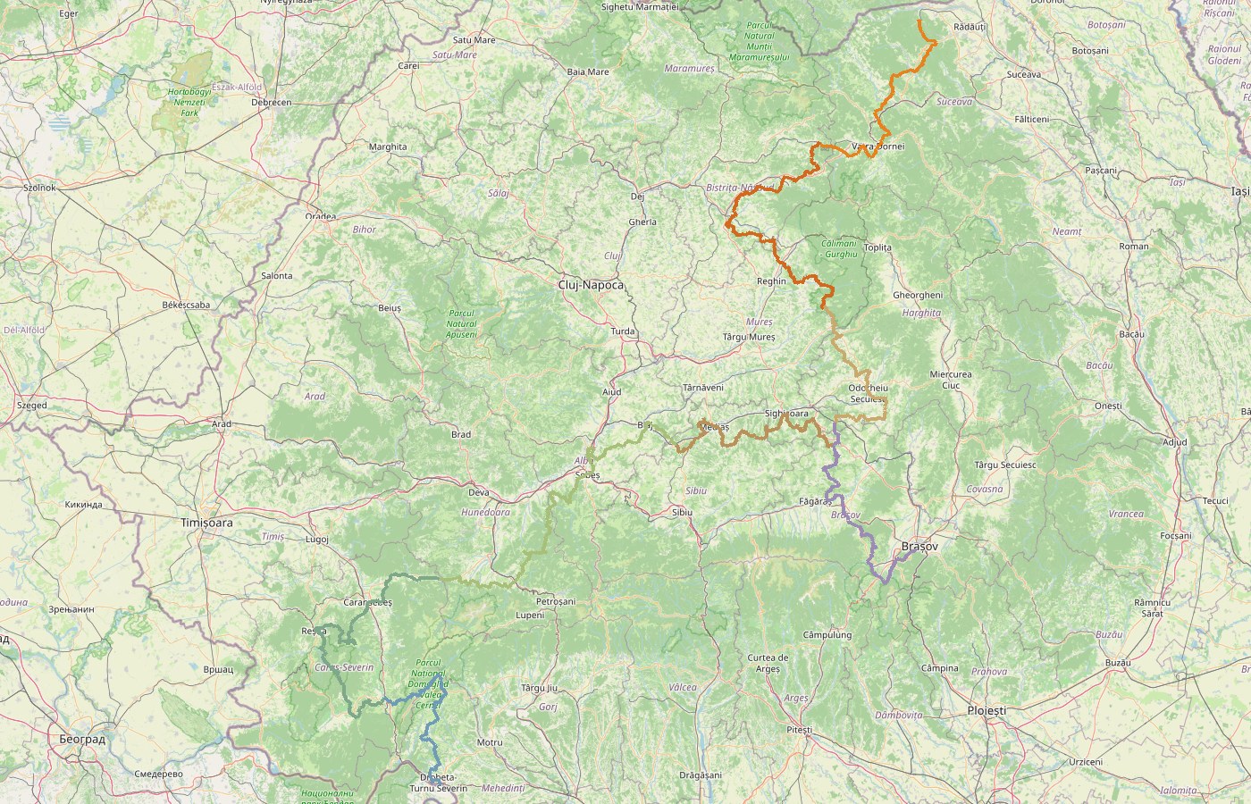
In 2018 the Tășuleasa Social association began waymarking a path from Putna to Drobeta-Turnu Severin. Not a ridge route, not a mountain road: a way that links villages, monasteries, citadels and people, public and open to anyone on foot, by bike or on horseback.
The waymark is an orange T in a circle, on a white background. The orange arrow points towards Drobeta, the white one towards Putna. Every kilometre there stands an andesite milestone, carved by art students, with the kilometre number and the logo. No two are alike.
Each land has its own colour on the official map, and each colour means a day of walking. Bucovina is the first, and it is ours.
For now we have written at length about Bucovina, the land we know step by step. The rest will follow.
Rutele, pe ținuturi
Before departure
The stamps go into a booklet you buy from the official shop. The app has the stages, the elevation profiles and offline maps that work without signal: on the Obcine ridges, signal drops out often.
The trail runs through Sadova and Fundu Moldovei, half an hour from the house, and climbs to the Mestecăniș pass. The nearest milestone is six kilometres from the gate.
If you are still deciding
Seven stages, 144 km, from Putna Monastery to Poiana Negri. We have written each one out: the route, the lodgings with prices and phone numbers, where to get the stamp, where the water is.
Book direct
No platform commission. Self check-in, late check-out when possible and free cancellation up to seven days before.